The Power of Satellite Imagery
The Power of Satellite Imagery
The Power of Satellite Imagery
Personal
2 weeks
AI, n8n, workflow automation
Personal
2 weeks
AI, n8n, workflow automation
Personal
2 weeks
AI, n8n, workflow automation
For individuals with a deep-seated interest in the intricacies of agronomy, grasping the vitality and condition of crops is of utmost importance. However, in today’s technologically advanced age, relying solely on visual observation is inadequate. This realization led to the conception of a personal project aimed at addressing this intricate challenge in the agricultural field.
Setting the Scene
Amidst sprawling agricultural lands, a close collaboration was established with local farmer cooperatives, leveraging technology to enhance crop yields and maintain optimal crop health. Despite these advancements, a persistent issue arose daily, challenging the aspirations of precision agriculture.
The Problem at Hand
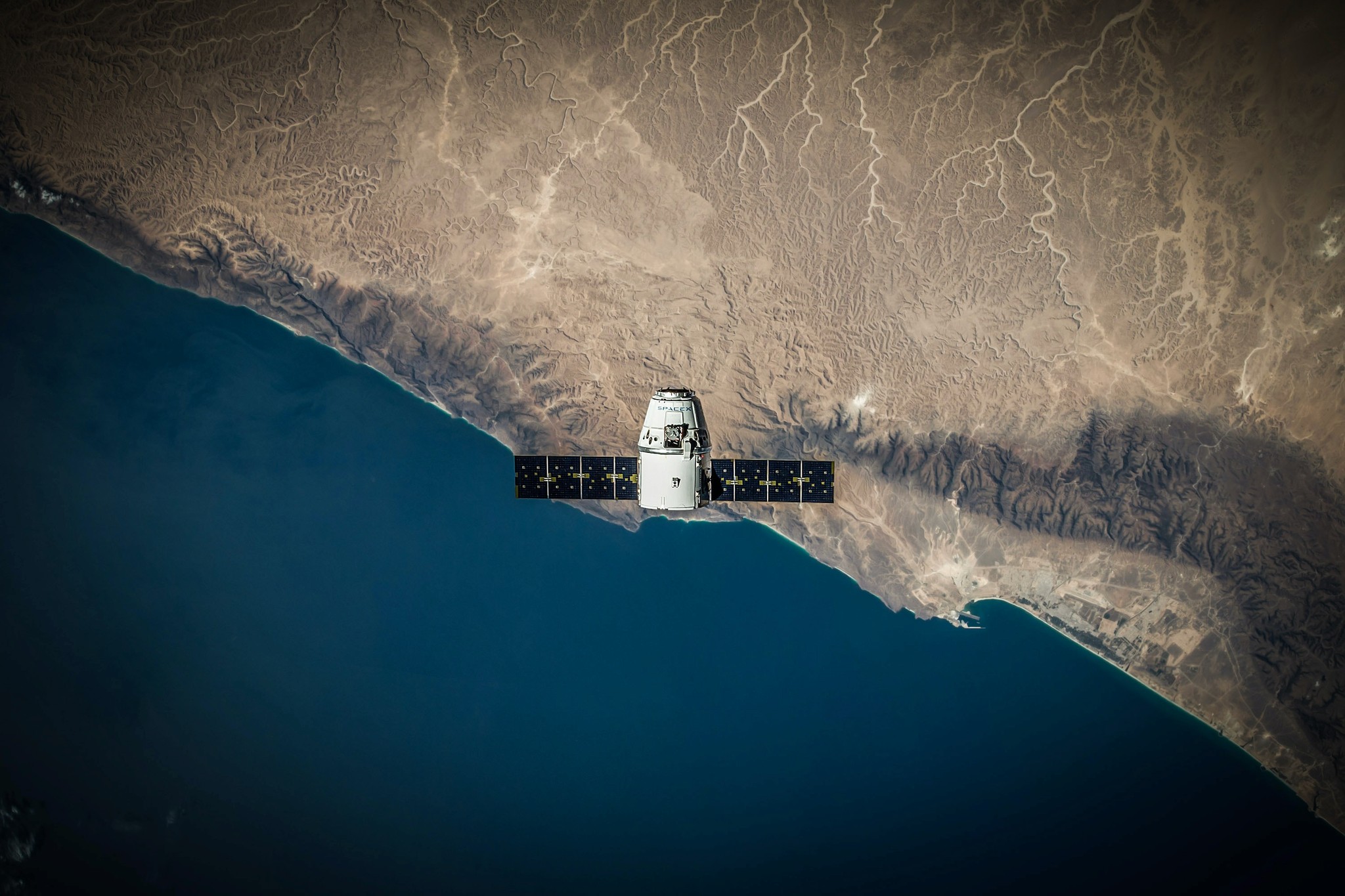
The necessity for daily monitoring of NDVI (Normalized Difference Vegetation Index) became apparent, a critical element for comprehensive crop analysis. The available satellite imagery from Sentinel Hub showed promise, yet integrating these images into a database for effective storage and analysis of NDVI, MDMI, and NDMI values proved challenging.
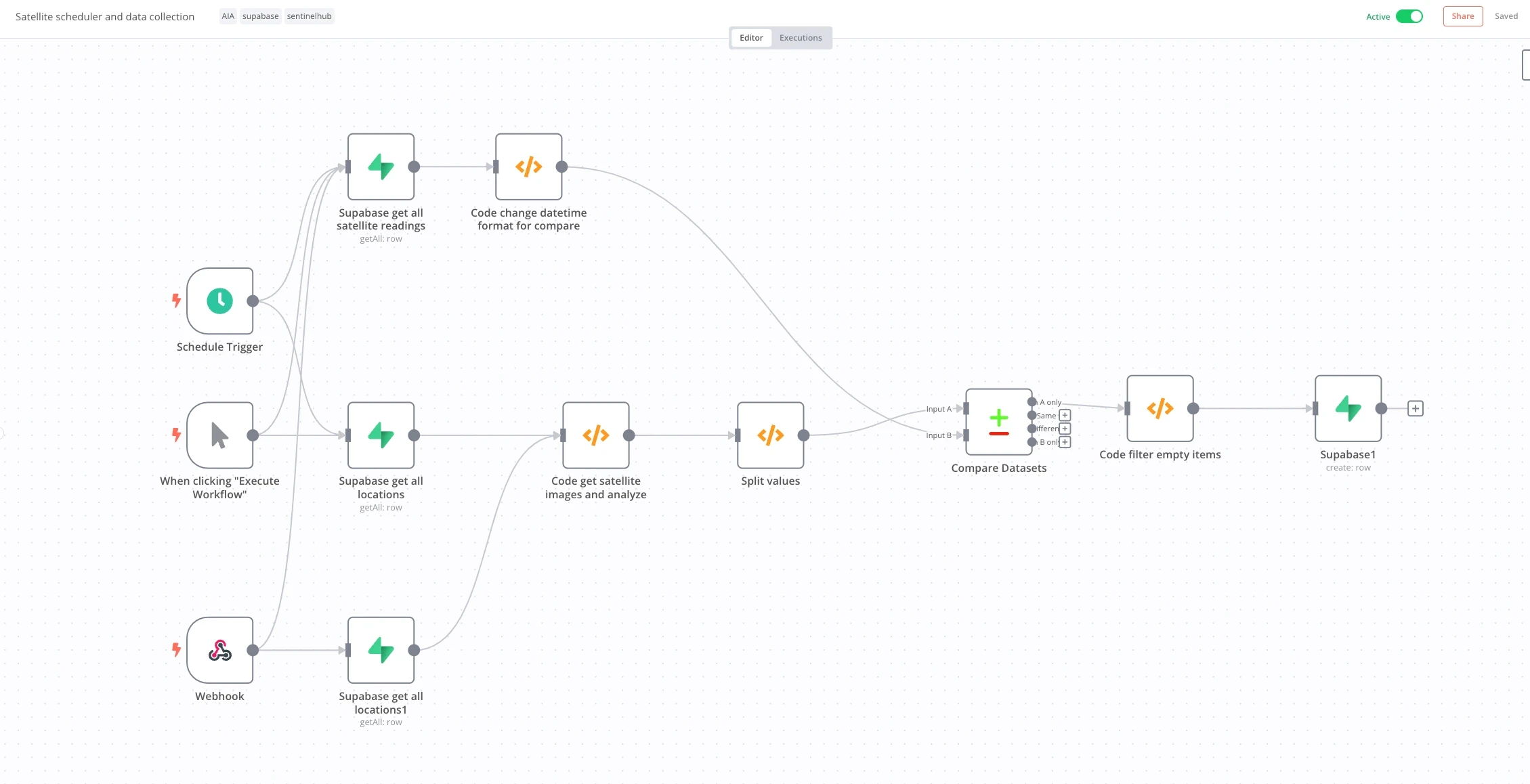
Crafting a Personal Solution
The solution emerged as both elegant and resilient. The project involved:
Image Procurement: Sourcing imagery directly from Sentinel Hub.
Analysis: Employing ImageJS in combination with NodeJS for an in-depth analysis of the images.
Data Conversion: Transforming the imagery into valuable NDVI, MDMI, and NDMI data.
Database Storage: Securely storing the analyzed data in Postgres, setting the stage for advanced crop analysis.
The integration of NASA’s harmonized Landsat/Sentinel database further enhanced the project, ensuring updated values every three days.
Reaping the Benefits
This sophisticated setup offered multiple advantages:
Advanced Crop Analysis: Daily updates to the database empowered farmers to detect early signs of diseases, water shortages, and inconsistencies in growth.
Economic Efficiency: Compared to market alternatives, this personal project provided a cost-effective solution.
A user shared their experience, highlighting the project’s transformative impact:
"Market solutions were charging over 15k annually just for some NDVI data. This personal project brought it down to just 500 a month."
Overcoming Technical Hurdles
While the journey was marked by innovation, it was not without its technical challenges. Converting PNG images into actual NDVI values required skillful maneuvering, particularly with the intricate workings of NodeJS and ImageJS. Nevertheless, with determination and technical expertise, these challenges were surmounted.
Embracing the Future of Agronomy
For agronomists or anyone looking to integrate diverse services for precision farming, this personal project marks a significant step forward. It is more than just a service; it’s a commitment to fostering efficient and innovative agricultural practices.
For individuals with a deep-seated interest in the intricacies of agronomy, grasping the vitality and condition of crops is of utmost importance. However, in today’s technologically advanced age, relying solely on visual observation is inadequate. This realization led to the conception of a personal project aimed at addressing this intricate challenge in the agricultural field.
Setting the Scene
Amidst sprawling agricultural lands, a close collaboration was established with local farmer cooperatives, leveraging technology to enhance crop yields and maintain optimal crop health. Despite these advancements, a persistent issue arose daily, challenging the aspirations of precision agriculture.
The Problem at Hand
The necessity for daily monitoring of NDVI (Normalized Difference Vegetation Index) became apparent, a critical element for comprehensive crop analysis. The available satellite imagery from Sentinel Hub showed promise, yet integrating these images into a database for effective storage and analysis of NDVI, MDMI, and NDMI values proved challenging.
Crafting a Personal Solution
The solution emerged as both elegant and resilient. The project involved:
Image Procurement: Sourcing imagery directly from Sentinel Hub.
Analysis: Employing ImageJS in combination with NodeJS for an in-depth analysis of the images.
Data Conversion: Transforming the imagery into valuable NDVI, MDMI, and NDMI data.
Database Storage: Securely storing the analyzed data in Postgres, setting the stage for advanced crop analysis.
The integration of NASA’s harmonized Landsat/Sentinel database further enhanced the project, ensuring updated values every three days.
Reaping the Benefits
This sophisticated setup offered multiple advantages:
Advanced Crop Analysis: Daily updates to the database empowered farmers to detect early signs of diseases, water shortages, and inconsistencies in growth.
Economic Efficiency: Compared to market alternatives, this personal project provided a cost-effective solution.
A user shared their experience, highlighting the project’s transformative impact:
"Market solutions were charging over 15k annually just for some NDVI data. This personal project brought it down to just 500 a month."
Overcoming Technical Hurdles
While the journey was marked by innovation, it was not without its technical challenges. Converting PNG images into actual NDVI values required skillful maneuvering, particularly with the intricate workings of NodeJS and ImageJS. Nevertheless, with determination and technical expertise, these challenges were surmounted.
Embracing the Future of Agronomy
For agronomists or anyone looking to integrate diverse services for precision farming, this personal project marks a significant step forward. It is more than just a service; it’s a commitment to fostering efficient and innovative agricultural practices.
Other Projects
© Copyright 2023. All rights Reserved.
Made by
© Copyright 2023. All rights Reserved.
Made by

Now Available
Now Available